So he built Cyclonauts. It’s free. It reads your Strava rides, matches them to OpenStreetMap, and keeps score: the roads and cycle paths you’ve covered, how much of each municipality, region and country you’ve ridden, and how far along you are on long routes like the Mauerweg. Marko answered our questions in writing.
Where it started
He describes himself as a software engineer, “data nerd” and enthusiastic cyclist, based in Berlin. The riding took off during the pandemic:
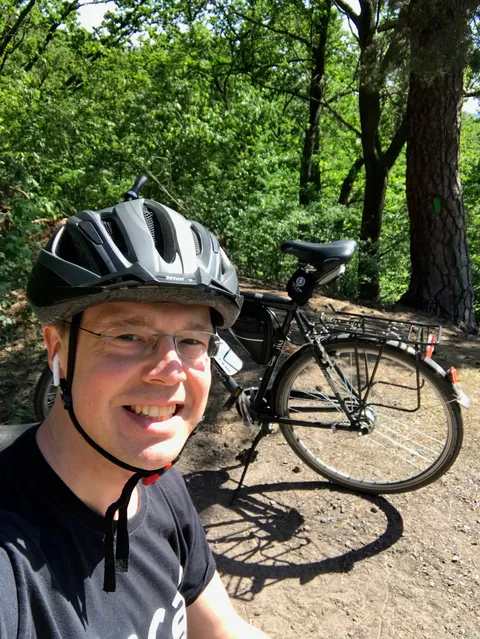
I started cycling extensively during Corona and quickly discovered my love for gamification and exploration. Berlin is such a beautiful city when you’re not sitting in a car or train! At some point I wondered how much of the Berlin Mauerweg cyclepath (a 160km cycling trail following the old Berlin Wall) I had accidentally ridden over the years. None of the apps I was using on Strava could provide an easy answer, so I got to work.
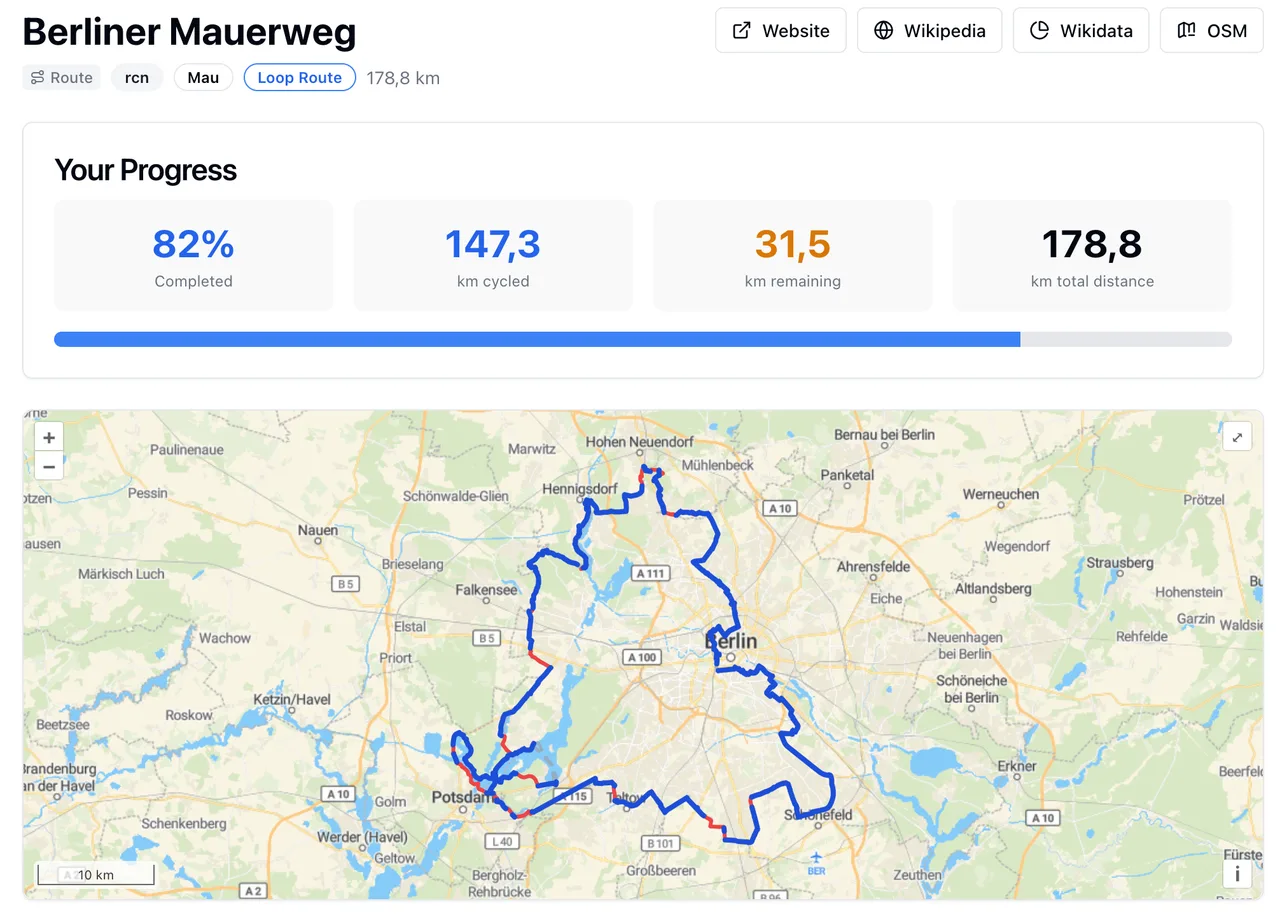
The Mauerweg is still the demo on the Cyclonauts homepage, and it’s his own progress: the counter sits at 82 percent, 147.3 km ridden and 31.5 km to go. Cyclonauts gives the route as 178.8 km; Berlin’s tourist board gives 160.
The project is older than its launch date. The privacy policy is dated November 2022 and the public changelog starts in July 2024. He says it spent a while in a family and friends beta before the official launch at the start of 2026. He’s the whole team, and as for riders: “Currently around 100, and constantly growing :)”
Roads, places and cycle paths
The focus, as he puts it:
The project focus is currently on administrative areas (countries, states, municipalities etc.), cycleable roads and explorable relations like cyclepaths. Ideally based on OpenStreetMap data.
A relation is OpenStreetMap’s way of grouping many pieces of map into one object, which is how a named route like the Mauerweg becomes one thing you can complete. Cyclonauts added a Cycle Paths section in June 2026 for exactly that: routes from local trails up to multi-country ones split into sections, each with its own progress bar. Since September 2026 each ride also shows how many new cycle path kilometers it earned. For places, every country, state and city it supports gets its own dashboard, and there’s an achievement for riding in every district of a city or every state of a country.
Which places are supported is the slow part.
I started with Europe, and am adding countries with good cycling infrastructure. This is work in progress though. Every new country is quite a bit of work to get right.
The coverage page listed 75 countries when we checked: most of Europe, plus the US, Canada, Mexico, Peru, Morocco, Australia, New Zealand, Japan, India and a run of countries across Asia, from the Caucasus and Central Asia to Southeast Asia. Covered means the full OpenStreetMap street catalogue is imported and kept updated, with city, district and state boundaries mapped. Rides anywhere else get base stats only. The US needed a rework of the map import in August 2025 so big countries could be split by state. It depends on the map data, too: when he added Malaysia and Laos, municipality data was missing, “a problem that should be fixed in OSM,” the changelog says.
“It’s the wild west out there”
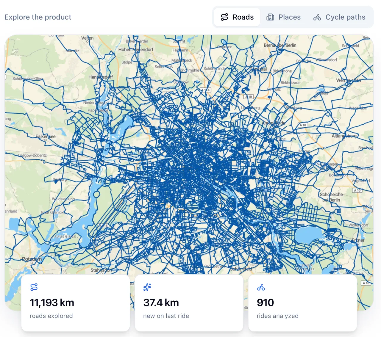
A new ride triggers the processing pipeline, which matches the activity GPS data against the local OpenStreetMap road database. Once we have the match graph, a lot of additional data can be computed and persisted, e.g. vector tilesets for the map, achievements and unique new explored kilometers.
Easier said than done, it’s the wild west out there. GPS data is messy, and if you just match against the nearest OSM road you will get interesting results. This was one of the trickiest parts to get right and I’m still constantly tweaking the algorithm.
The changelog shows what getting it right has involved. In January 2025 the map import started filtering out service roads with certain types of barriers, roads that have a separate cycle lane, and bus lanes. In February 2026 he found a bug that had been corrupting match data for three months, reprocessed it, and wrote “Apologies!” at the end of the note. In June 2026 he fixed a bug that came from people who record the ride to the station, take the train, then carry on recording: the jump showed up as a straight line many kilometers long, and Cyclonauts had been matching it to roads. Now it’s ignored.
Ten to twenty hours a week, unless it’s sunny
My day job is managing development teams, which means meetings, meetings, and then more meetings. This hobby project is one way to stay fresh and grounded. I spend around 10-20h per week on Cyclonauts, depending on the weather. If it is nice, I’m on the bike :) Money wise it’s not that much yet, maybe 20 EUR for a medium sized server.
The 20 EUR is a month, for a rented server, and he told us the biggest cost isn’t computing but storage: “the OSM cycling data is HUGE.” On the site’s roadmap he writes that the infrastructure he pays for out of hobby money can support a fixed number of users, and that “some sort of (super low) monetization would be nice” to pay for more. The About page says it’s free for now and he isn’t planning to charge beyond possibly covering infrastructure costs. In September 2026 he moved the map from MapTiler to OpenFreeMap “to save a bit of budget,” and satellite maps went with it.
The same day he noted a spike in signups: Strava limits small projects to a low number of requests per day, so onboarding can sometimes be “quite delayed,” and he’s tuning things to speed it up. If your map fills in slowly at first, that’s the reason he gives.
Who it’s for
I think there’s a tribe out there that is motivated by stats, gamification and exploration. Not everyone, but this is what helps me drag my lazy ass into the saddle and spend hours on my bike in the countryside. Try Cyclonauts or a similar app that tracks exploration progress and see if it clicks for you. If it does, your commute will get longer and much more exciting!
It’s a cycling app. It counts bike rides, and since July 2026 e-bike rides too, which it treats the same way. If you want your runs and walks scored, Wandrer also matches activities to OpenStreetMap and keeps separate foot and bicycle scores; its free account imports 50 of your past activities from Strava. The tile games, where entering a grid square is what counts, are in our comparison of Strava exploration apps.
| Before you connect | Cyclonauts |
|---|---|
| Price | Free; he may charge later to cover server costs |
| Rides counted | Bike and e-bike |
| Full road stats | 75 countries on its coverage list (October 2026); base stats elsewhere |
| Map data | OpenStreetMap |
| Sign-up | Connect Strava first, then finish your account (Google sign-in, or email and password) |
| On Strava | Reads your rides, including private ones, and posts the achievements a ride earns back to Strava |
| Where data lives | A server in the EU, per its privacy policy |
| Made by | Marko Schilde, Berlin, on his own |
We asked if there was anything he wanted people to know. He went past the app:
If you’re like-minded and want to cooperate just reach out! I’m always looking for new connections and opportunities. IMO we haven’t reached the final state of the cycling ecosystem, there’s so many things that can be improved.
He’s on Bluesky, and the support page has his email. Coverage, pricing and the link to the site are on the Cyclonauts listing.
Sources
- Written answers from Marko Schilde, October 5, 2026, quoted as he wrote them with some sentences left out, and the two screenshots he sent with them
- Cyclonauts: its About page (changelog, country coverage, roadmap), privacy policy, terms and imprint, checked October 5, 2026 and again October 13, 2026, and its sign-up page
- visitBerlin on the Mauerweg (160 km)
- OpenStreetMap Wiki: Relation
- Wandrer FAQ