What is Cyclonauts?
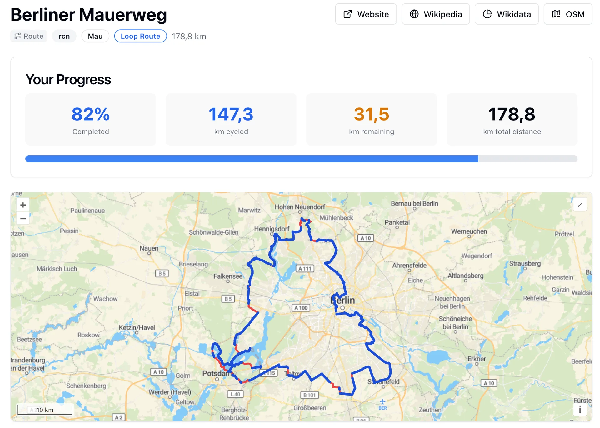
Cyclonauts reads your Strava rides, matches each one against OpenStreetMap, and keeps score in three ways: the roads and cycle paths you've covered, how much of each country, state, city and district you've ridden, and how far along you are on named routes. The demo on its homepage is the Berliner Mauerweg, the trail that follows the old Berlin Wall, sitting at 82 percent. That's the maker's own progress. He told us he built the app because none of the Strava apps he used could tell him how much of that route he'd ridden by accident over the years.
You sign up through Strava first, then finish the account with Google or an email and password. It works through your past rides, and new ones update every goal on their own. It's a one-person hobby project from Berlin, and it is free.
Key Features
A road map that keeps growing
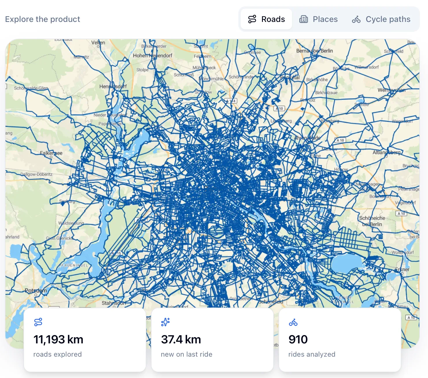
The road map draws every road you've ridden, and the homepage preview shows the totals that go with it: kilometers explored, new kilometers on your last ride, rides analyzed. The road catalogue is filtered, so some roads never count: it leaves out service roads with certain kinds of barriers, bus lanes, and roads that have a separate cycle lane beside them.
A dashboard for every place
The Geo Explorer gives each country, state and city that Cyclonauts supports its own page with your progress and achievements there, and its activity card links through to the rides behind the numbers. On the map, a zone layer colours each area by how much of it you've completed, from countries when you're zoomed out down to city districts up close.
Cycle paths as things to finish
The Cycle Paths section is new, added in June 2026. You can browse routes by country, by network (major or local) and by how far along you are, and each route gets a progress bar, its rideable length and a map overlay. Long routes made of sections show every section with its own progress. Each ride's detail page also shows the new cycle path kilometers it earned. The maker's roadmap still calls the cycle path stats "a bit crude", so expect this part to change.
Achievements, including first completions
A ride can earn achievements, which show on its detail page. One marks the first time you've ridden in every child zone of a place: every district of a city, say, or every state of a country.
Ride analysis
The activity analysis view highlights a ride's achievements and the areas it counted toward on the map when you hover over them. The homepage also pitches Cyclonauts as a way to find nearby gaps for your next ride.
Who It's For
- Riders who want a number for "how much of Berlin have I done", down to the district
- Route collectors chasing a long named cycle path one section at a time
- Commuters: the maker's pitch is that if exploration goals click for you, your commute will get longer
- E-bike riders, whose rides count the same as bike rides
What it doesn't do
It counts bike and e-bike rides. The site pitches it to cyclists and never mentions runs or walks. Full statistics need the country to be on its coverage list. Rides anywhere else get base stats only. There's no route planner yet (the roadmap says the maker wants to explore one), no leaderboards (also on the roadmap), and the site links no phone app; it runs in the browser. The interface is in English only for now, though you can switch units to imperial and pick your locale. Satellite maps went away in September 2026, when the maker moved to a cheaper map provider. And a new account can take a while to fill in. The maker wrote in September 2026 that Strava limits small projects to a low number of requests per day, so first-time processing can be delayed.
Which countries does Cyclonauts cover?
75 when we checked in October 2026. Most of Europe is in, along with the US, Canada, Mexico, Peru, Morocco, Australia, New Zealand, Japan, India and a run of countries across Asia, from Turkey and the Caucasus through Central Asia to Southeast Asia. Covered means the full OpenStreetMap street catalogue is imported and updated regularly, with city, district and state boundaries mapped. The coverage page shows each country's last data update. The stated plan is to cover every country, and new ones are added in batches.
Does Cyclonauts see my private Strava rides?
Yes. Its Strava connect link asks for permission to read all your activities, private ones included, plus your private routes, segments and events, and for permission to create and edit activities (Strava's write scope). Its changelog says the achievements a ride earns are posted back to Strava. Its privacy policy says it processes both past and future activities until you revoke access or delete your account, and that private data such as raw GPS tracks isn't shared with third parties or made public without your consent. Data is stored on a server in the European Union.
Will Cyclonauts stay free?
The About page says it's free for now, and the maker isn't planning to charge beyond possibly covering infrastructure costs one day. His roadmap explains why that might come up: the infrastructure he pays for out of hobby money can only support a fixed number of users, and a "super low" fee would pay for more. He told us a rented server costs him about 20 euros a month, and that the biggest cost is storing the OpenStreetMap cycling data.
What happens if I disconnect Strava and reconnect later?
Since October 2026, Cyclonauts looks for the activities you added while it was disconnected and picks them up when you reconnect. If you want to leave instead, the privacy policy says you can deactivate your account and delete all its data at any time, on the site or by email.