What is Tisseur de Voies?
Tisseur de Voies (roughly "weaver of ways") is a free web map for planning rides in France that end with a train home. The idea is simple: take the train out to one station, then ride back to another along a signposted cycle route, or ride out and train back. It puts the cycle routes and the French rail network (TER, Transilien, RER, Intercités) on one map and offers thousands of loops worked out in advance, each with its distance, climbing and the networks it follows. You can browse by starting city, by cycle route or by setting (forest, sea, lakes, mountains, heritage), and nothing asks you to sign up.
It's built from open data: OpenStreetMap for the cycle route tracks, France's national cycle route observatory (ONV) for the official routes, and SNCF and Île-de-France Mobilités timetables for the trains. The About page tells the story of Nicolas, a road-turned-gravel rider who spent ages planning rides by cross-checking a train map, a cycle route map and a map of the tiles he hadn't ridden yet, and wrote the tool to put all three on one screen.
Key Features
Loops between two stations
Filter by distance and climbing, click a loop to see the train leg and the ride, then download the GPX for Komoot, Strava, Garmin Connect, Wahoo or your bike computer. The Partager (share) button copies a direct link to what you're looking at.
Every level of signposted route
The network layers run from EuroVelo and international routes down to national, regional, departmental and local ones. The guide suggests turning on the EuroVelo layer with the train layer to plan multi-day bikepacking trips on routes like the EV6, the EV3 Scandibérique or La Vélodyssée, with stations to join and leave by.
À portée de train (within train range)
A map and ranking for 60 French cities showing how many loops you can reach by direct train, no changes, in anything from 30 minutes to 3 hours. Paris leads at under an hour; the method explains how journey times are worked out. The map can be embedded elsewhere under CC BY 4.0.
Your Strava tiles on the map
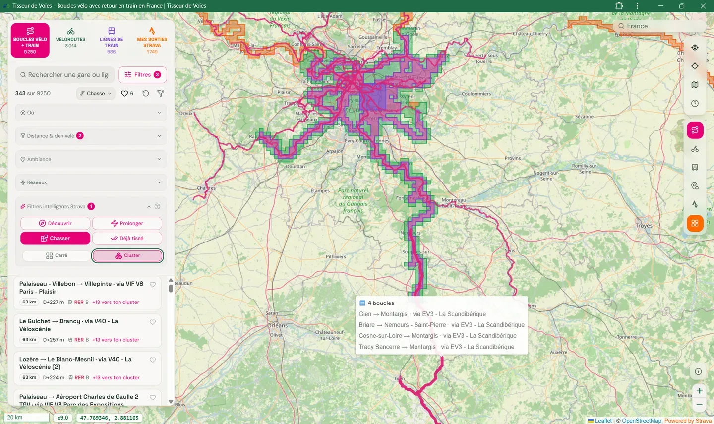
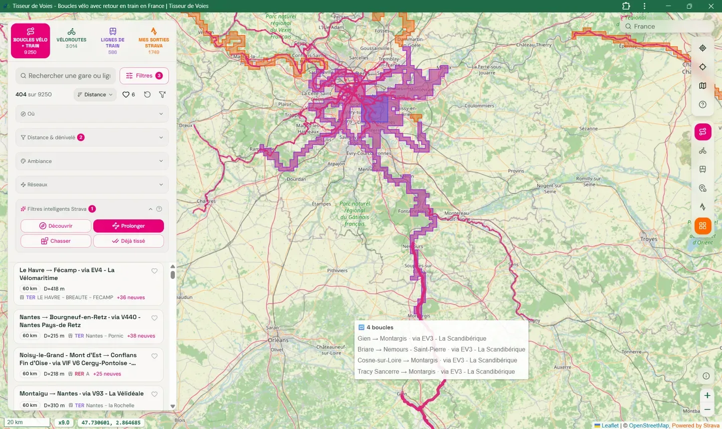
Connect Strava and your coverage shows on the map in roughly 1 km² explorer tiles, the grid VeloViewer and StatsHunters made popular. Three loop filters then come into play: Découvrir (discover) shows only loops through tiles you've never visited, Prolonger (extend) picks loops that push a little past the areas you already know, and Chasser (hunt) targets the loops that would grow your Max Square or your Max Cluster.
Stamps and a loop passport
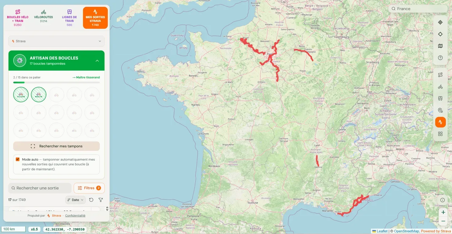
A loop counts as ridden when one of your activities covers at least 90% of it. Each one goes into a passport with five levels, from your first stamped loop to your fiftieth. "Rechercher mes tampons" (find my stamps) scans your Strava history and collects the ones you'd already earned before signing up.
Who It's For
- Riders in France who'd rather not ride out and back, and are happy to let a train do one of the legs
- Tile hunters who already know their Max Square from StatsHunters or VeloViewer and want a weekend loop that adds to it, with the train back already worked out
- Bikepackers planning a few days on a EuroVelo route who need to see where the stations are along it
Worth Knowing
The Strava connection is optional and read-only unless you ask for more. By default it requests activity:read_all, which includes private activities, used only to work out your coverage and filter loops. A second permission, activity:write, is asked for only if you turn on posting stamps to Strava, and then it adds a "🎖️ Boucle vélo-train" stamp to the description of an activity you choose, or, if you switch on auto mode, to each new ride that covers a loop. The privacy policy is specific about storage: your Strava tokens live in an encrypted HttpOnly session cookie for at most 30 days, your activities are cached in your browser for at most 7 days, your stamps (with the matching Strava activity IDs) stay in your browser until you disconnect, tile coverage is recalculated in the open tab and never saved, and none of it is pooled with other users or used for AI. "Déconnecter et supprimer" (disconnect and delete) revokes access and wipes the Strava data from that device. The site is in French and covers France only.